
1.2.1. Water Quality and Aquatic Ecosystems Health
Type of resources
Topics
Keywords
Contact for the resource
Provided by
Years
Formats
Representation types
Update frequencies
status
-
As part of a three year study funded by Environment and Climate Change Canada and Natural Resources Canada (ecoENERGY Innovation Initiative, project UOSGQ963; http://www.nrcan.gc.ca/energy/funding/current-fundingprograms/eii/4985) data were gathered to assess and monitor water quality conditions in northeastern British Columbia (BC). Defined in this datasetas portions of the Petitot, Fort Nelson, and Hay River basins, northeast BC is a region subject to both historical conventional oil and gas development and more recent unconventional oil and gas (UOG) development. UOG development in this area is presently focused on the Horn River Basin, Cordova Embayment and Liard Basin shale formations (BCOGC 2010, 2013a). Otherwise, UOG development in BC is centered in the Montney Play, located further south (Adams et al. 2016). Surface water quality assessment and monitoring focused on two river basins in this area: the Petitot River Basin and the Fort Nelson River Basin. Baseline and/or best available surface water quality information was gathered from January 2012 to March 2015. Benthic macroinvertebrates were collected over the same period to complement the water quality study through development of a Canadian Aquatic Biomonitoring Network (CABIN) bioassessment model. Routine Water Quality Monitoring study objectives were to gain a better understanding of water quality conditions in the Petitot River Basin by collecting baseline data using a standard suite of physical-chemical variables and establishing a representative long-term site. Routine water quality sampling sites were selected at locations with known exposure to UOG activity and varying watershed areas; submersible loggers were also installed to collect specific conductance and temperature data. Synoptic Water Quality Monitoring study objectives were to establish patterns of spatial and temporal water chemistry through synoptic water sampling at high and low flow periods and examine potential relationships between UOG activity and surface water quality. Sample sites were selected at microbasin drainage outlets to represent a range of upstream activity and potential contamination. A series of samples were also collected along the mainstem Petitot River at 20-kilometre intervals from the Alberta border to the Highway 77 bridge to capture potential “step-changes” in water chemistry as the river flows through the northeast BC gas production area. Biological Monitoring study objectives were to establish baseline reference conditions based on benthic macroinvertebrate communities and habitat characteristics, and develop a predictive bioassessment model to assess the ecosystem health of streams in the Liard, Fort Nelson, and Petitot River basins exposed to UOG activity. The biological monitoring study design followed CABIN sampling methodology for benthic macroinvertebrate collections in streams and rivers (Environment Canada 2012, http://www.ec.gc.ca/rcba-cabin). Sampling was conducted at 53 reference sites unaffected or minimally influenced by human activity. Thirty five test sites were also selected across a gradient of UOG activity, based on well densities. A preliminary predictive bioassessment model for northeast BC was established and is available through the CABIN website for future assessment of water quality and ecosystem health in the region.
-
The Canadian Aquatic Biomonitoring Network (CABIN) is an aquatic biomonitoring program for assessing the health of fresh water ecosystems in Canada. Benthic macroinvertebrates are collected at a site location and their counts are used as an indicator of the health of that water body. CABIN is based on the network of networks approach that promotes inter-agency collaboration and data-sharing to achieve consistent and comparable reporting on fresh water quality and aquatic ecosystem conditions in Canada. The program is maintained by Environment and Climate Change Canada (ECCC) to support the collection, assessment, reporting and distribution of biological monitoring information. A set of nationally standardized CABIN protocols are used for field collection, laboratory work, and analysis of biological monitoring data. A training program is available to certify participants in the standard protocols. There are two types of sites in the CABIN database (reference and test). Reference sites represent habitats that are closest to “natural” before any human impact. The data from reference sites are used to create reference models that CABIN partners use to evaluate their test sites in an approach known as the Reference Condition Approach (RCA). Using the RCA models, CABIN partners match their test sites to groups of reference sites on similar habitats and compare the observed macroinvertebrate communities. The extent of the differences between the test site communities and the reference site communities allows CABIN partners to estimate the severity of the impacts at those locations. CABIN samples have been collected since 1987 and are organized in the database by study (partner project). The data is delineated by the 11 major drainage areas (MDA) found in Canada and each one has a corresponding study, habitat and benthic invertebrate data file. Links to auxiliary water quality data are provided when available. Visits may be conducted at the same location over time with repeat site visits being identified by identical study name / site code with different dates. All data collected by the federal government is available on Open Data and more partners are adding their data continually. The csv files are updated monthly. Contact the CABIN study authority to request permission to access non open data.
-

This dataset provides marine bacteriological water quality data for bivalve shellfish harvest areas in Nova Scotia, Canada. Shellfish harvest area water temperature and salinity data are also provided as adjuncts to the interpretation of fecal coliform density data. The latter is the indicator of fecal matter contamination monitored annually by Environment and Climate Change Canada (ECCC) within the framework of the Canadian Shellfish Sanitation Program (CSSP). The geospatial positions of the sampling sites are also provided. These data are collected by ECCC for the purpose of making recommendations on the classification of shellfish harvest area waters. ECCC recommendations are reviewed and adopted by Regional Interdepartmental Shellfish Committees prior to regulatory implementation by Fisheries and Oceans Canada (DFO).
-
Observations on various types of wetlands, terrestrial environments, and vascular plants for 102 sites visited in 2012 and located on Lake Saint-Pierre are included in this dataset. Since the 1970s, Environment and Climate change Canada (ECCC) has been monitoring changes in wetlands under the State of the St. Lawrence River Monitoring program of the St. Lawrence Action Plan.
-
Observations on various types of wetlands, terrestrial environments, and vascular plants for 55 sites visited in 2012 and located in in the Boucherville Islands are included in this dataset. Since the 1970s, Environment and Climate Change Canada (ECCC) has been monitoring changes in wetlands under the State of the St. Lawrence River Monitoring program of the St. Lawrence Action Plan.
-

This dataset provides marine bacteriological water quality data for bivalve shellfish harvest areas in New Brunswick, Canada. Shellfish harvest area water temperature and salinity data are also provided as adjuncts to the interpretation of fecal coliform density data. The latter is the indicator of fecal matter contamination monitored annually by Environment and Climate Change Canada (ECCC) within the framework of the Canadian Shellfish Sanitation Program (CSSP). The geospatial positions of the sampling sites are also provided. These data are collected by ECCC for the purpose of making recommendations on the classification of shellfish harvest area waters. ECCC recommendations are reviewed and adopted by Regional Interdepartmental Shellfish Committees prior to regulatory implementation by Fisheries and Oceans Canada (DFO).
-

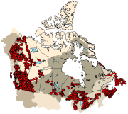
This dataset provides geospatial polygon boundaries for marine bivalve shellfish harvest area classification in British Columbia, Canada. These data represent the five classification categories of marine bivalve shellfish harvest areas (Approved; Conditionally Approved; Restricted; Conditionally Restricted; and Prohibited) under the Canadian Shellfish Sanitation Program (CSSP). Data are collected by Environment and Climate Change Canada (ECCC) for the purpose of making applicable classification recommendations on the basis of sanitary and water quality survey results. ECCC recommendations are reviewed and adopted by Regional Interdepartmental Shellfish Committees prior to regulatory implementation by Fisheries and Oceans Canada (DFO). These geographic data are for illustrative purposes only; they show shellfish harvest area classifications when in Open Status. The classification may be superseded at any time by regulatory orders issued by DFO, which place areas in Closed Status, due to conditions such as sewage overflows or elevated biotoxin levels. For further information about the current status and boundary coordinates for areas under Prohibition Order, please contact your local DFO office.
-

This dataset provides marine bacteriological water quality data for bivalve shellfish harvest areas in Quebec, Canada. Shellfish harvest area water temperature and salinity data are also provided as adjuncts to the interpretation of fecal coliform density data. The latter is the indicator of fecal matter contamination monitored annually by Environment and Climate Change Canada (ECCC) within the framework of the Canadian Shellfish Sanitation Program (CSSP). The geospatial positions of the sampling sites are also provided. These data are collected by ECCC for the purpose of making recommendations on the classification of shellfish harvest area waters. ECCC recommendations are reviewed and adopted by Regional Interdepartmental Shellfish Committees prior to regulatory implementation by Fisheries and Oceans Canada (DFO).
-

This dataset provides marine bacteriological water quality data for bivalve shellfish harvest areas in Prince Edward Island, Canada. Shellfish harvest area water temperature and salinity data are also provided as adjuncts to the interpretation of fecal coliform density data. The latter is the indicator of fecal matter contamination monitored annually by Environment and Climate Change Canada (ECCC) within the framework of the Canadian Shellfish Sanitation Program (CSSP). The geospatial positions of the sampling sites are also provided. These data are collected by ECCC for the purpose of making recommendations on the classification of shellfish harvest area waters. ECCC recommendations are reviewed and adopted by Regional Interdepartmental Shellfish Committees prior to regulatory implementation by Fisheries and Oceans Canada (DFO).
-

This dataset provides geospatial polygon boundaries for marine bivalve shellfish harvest area classification in New Brunswick, Canada. These data represent the five classification categories of marine bivalve shellfish harvest areas (Approved; Conditionally Approved; Restricted; Conditionally Restricted; and Prohibited) under the Canadian Shellfish Sanitation Program (CSSP). Data are collected by Environment and Climate Change Canada (ECCC) for the purpose of making applicable classification recommendations on the basis of sanitary and water quality survey results. ECCC recommendations are reviewed and adopted by Regional Interdepartmental Shellfish Committees prior to regulatory implementation by Fisheries and Oceans Canada (DFO). These geographic data are for illustrative purposes only; they show shellfish harvest area classifications when in Open Status. The classification may be superseded at any time by regulatory orders issued by DFO, which place areas in Closed Status, due to conditions such as sewage overflows or elevated biotoxin levels. For further information about the current status and boundary coordinates for areas under Prohibition Order, please contact your local DFO office.